About
At Altitude Inspection Services, we specialize in Photogrammetry mapping as well as advanced aerial infrared mapping for industrial and structural assessments. Our mission is to provide accurate thermal data and Photogrammetry/Mapping Services. The direction of this mission is to provide analysis and solutions with an aim towards enhanced safety and operation efficiency. Reach out through our contact form to learn more about our tailored inspection solutions.
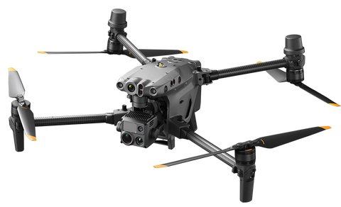
Our flagship drone,The DJI Matrice M30T is a powerhouse for commercial drone operations; it’s practically built for the kind of work you do at Altitude Inspection Services. Its rugged design, thermal imaging, and RTK mapping capabilities make it ideal for high-stakes, data-driven environments. With its IP55 weather resistance, 41-minute flight time, and multi-sensor payload (zoom, wide, thermal, laser rangefinder), the M30T is built for field-ready versatility. It’s not just a drone — it’s made AIS a mobile data acquisition platform for your operations success.
Portfolio